


.png)
The Official Plan for the Township of Laurentian Valley was adopted by Council on July 23, 2002, approved by the County of Renfrew with modifications on June 30, 2004 and by the Ontario Municipal Board by oral decision December 10, 2004.
What is an Official Plan?
An Official Plan describes Council's policies on how land within LV should be used. It is prepared with input from the public and helps to ensure that future planning and development will meet the specific needs of the community, while at the same time addressing the requirements of the Ontario Planning Act and the Provincial Policy Statement (PPS).
The Official Plan:
- Lets the public know what the municipality's general land use planning policies as set out by Council are;
- Makes sure that growth is coordinated and meets the community's needs by setting where and how growth will occur;
- Helps all members of the community understand how their land may be used now and in the future;
- Helps determine where roads, watermains, sewers, waste disposal, parks and other services will be needed and built;
- Provides a framework for establishing municipal zoning by-laws to set local regulations and standards, such as the types of uses that are permitted, size of lots, height of buildings, hazard lands and flood plain policies;
- Establishes where new housing, business, industry, offices and shops will be located;
- Identifies and sets out policies for the protection and use of natural resource areas such as agricultural lands, gravel pits & quarries and forestry;
- Identifies areas of hazard lands and natural features such as wetlands, lakes and rivers are located.
- Provides a way to evaluate and settle conflicting land uses while meeting local, regional and provincial interests; and
- Shows Council's commitment to the future growth of the community.
The Official Plan is made up of the text which contains the policies and various Map Schedules A, B and C, which set out the designations for each property. An Office Consolidation of the Official Plan is available on the website for convenience. While every effort is made to ensure that all amendments are included in the consolidation, there may be amendments that are pending approval that have not yet been included. Should you require further confirmation of the designation of a particular property, please contact the Township Planning Department for assistance at 613-735-6291.
LV Official Plan documents
|
Laurentian Valley Official Plan |
|
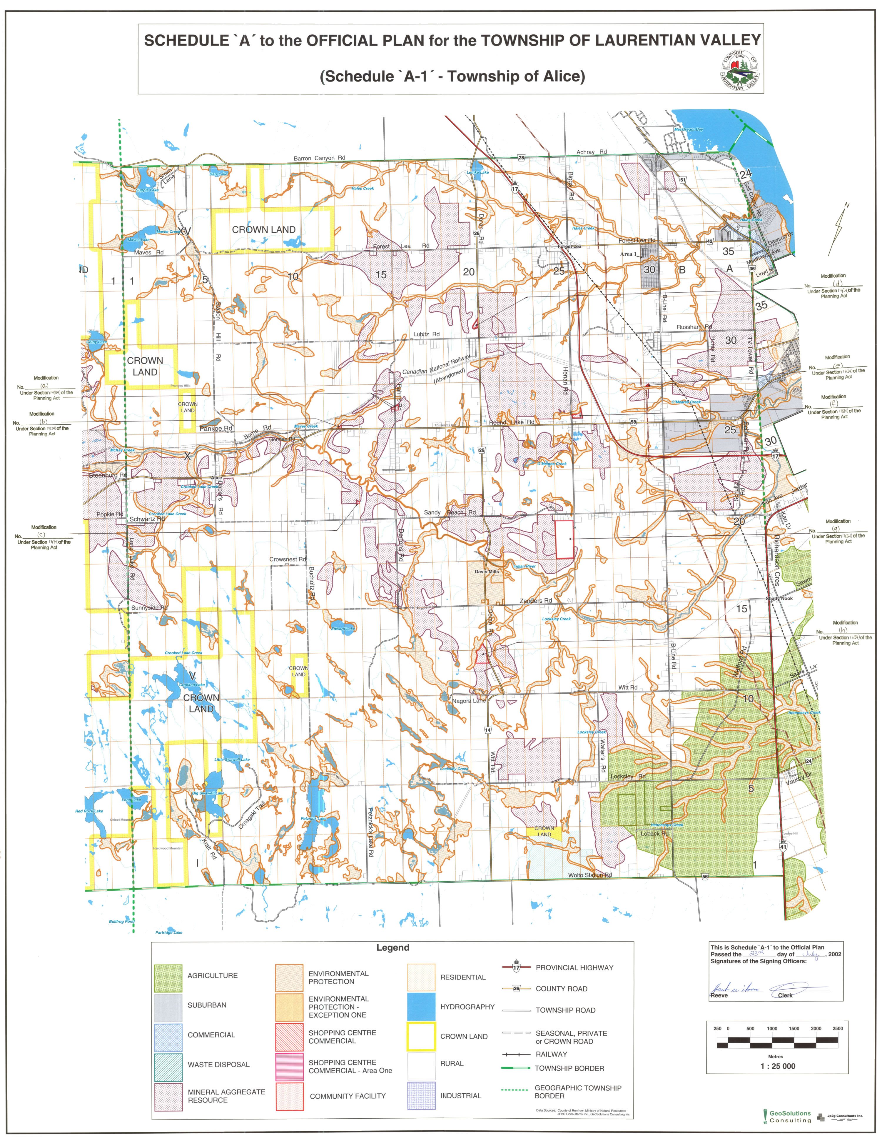
Schedule A1, Alice Township |
|
|
|
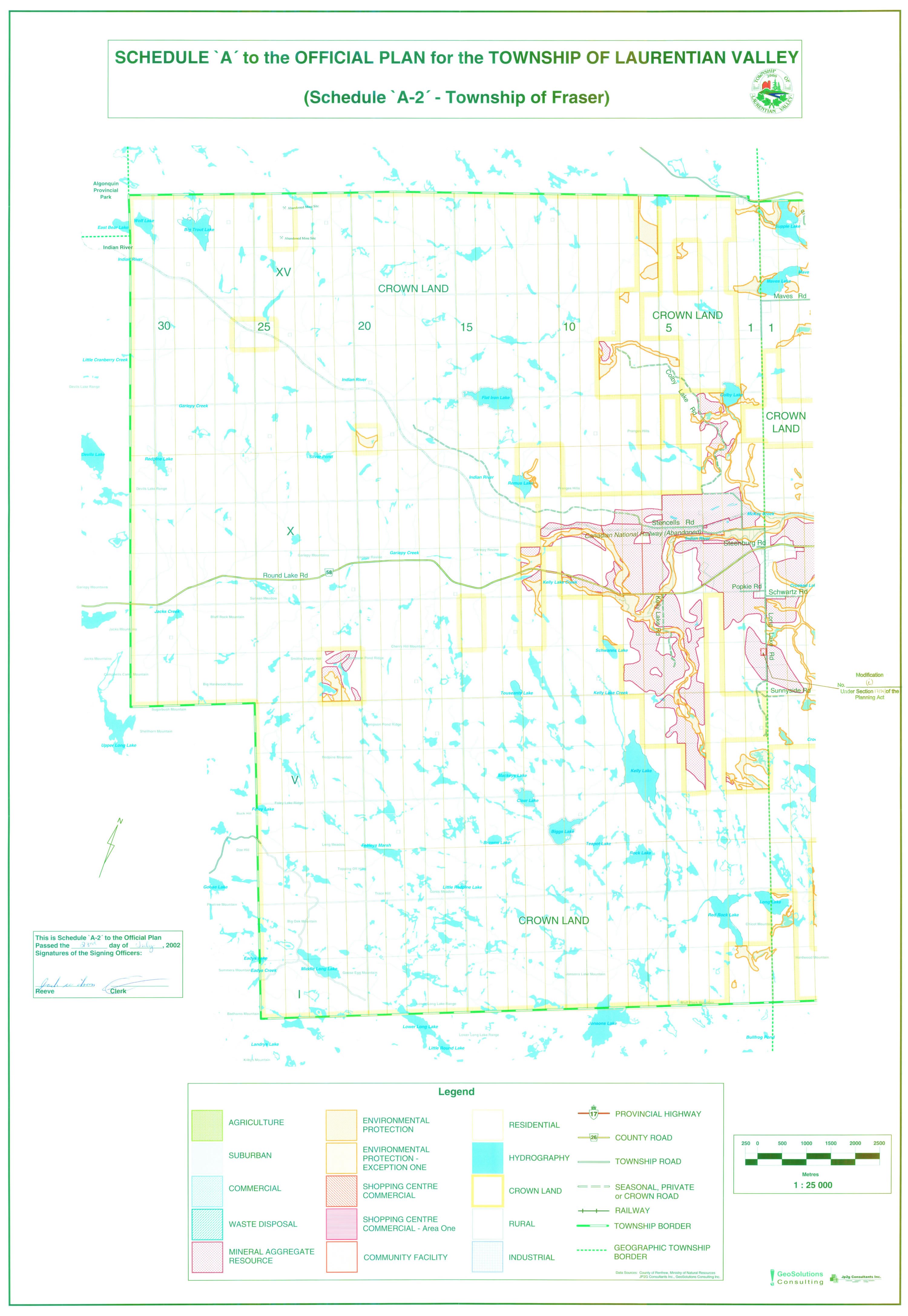
Schedule A2, Fraser Township |
|
|
|
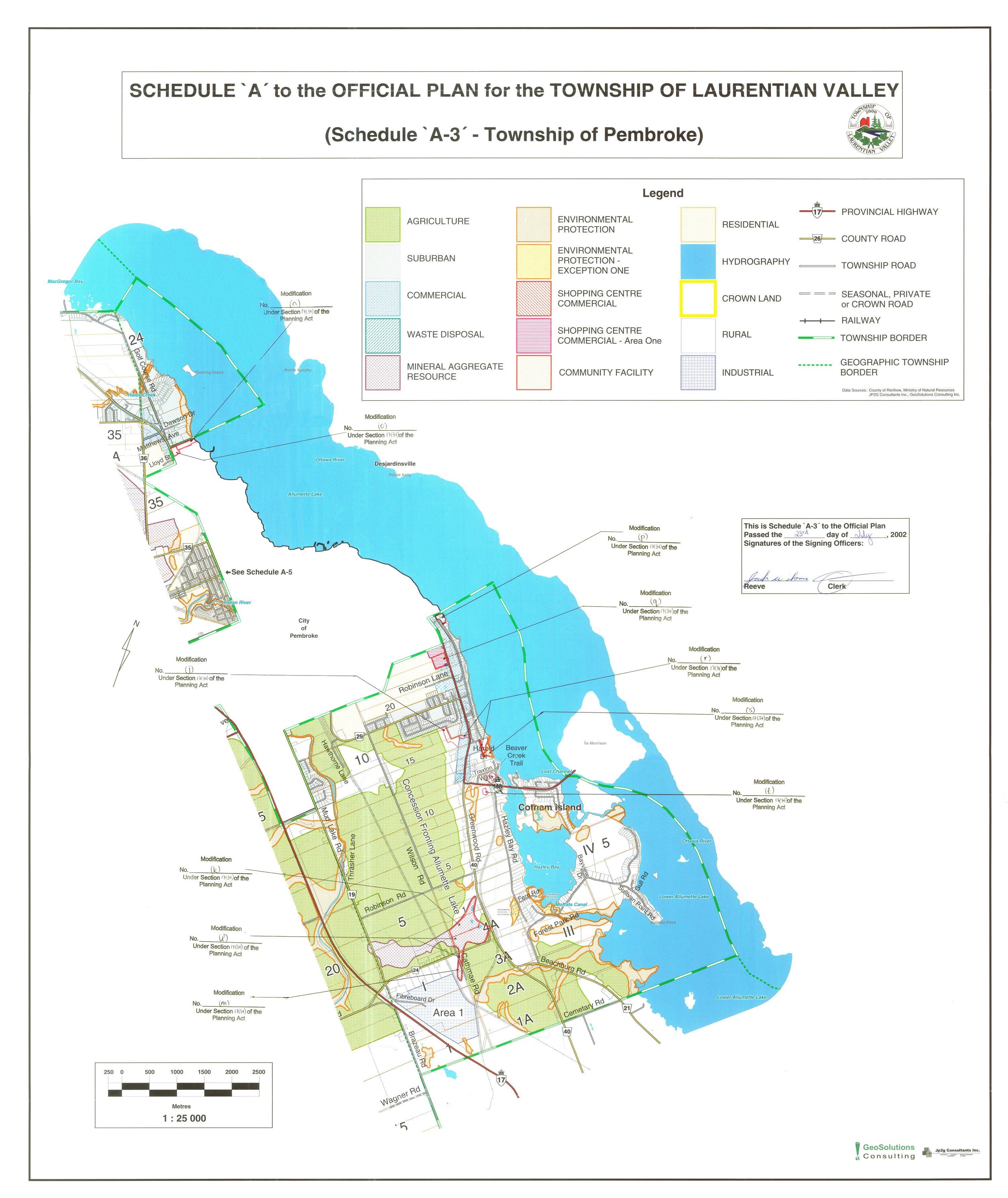
Schedule A3, Pembroke Township |
|
|
|
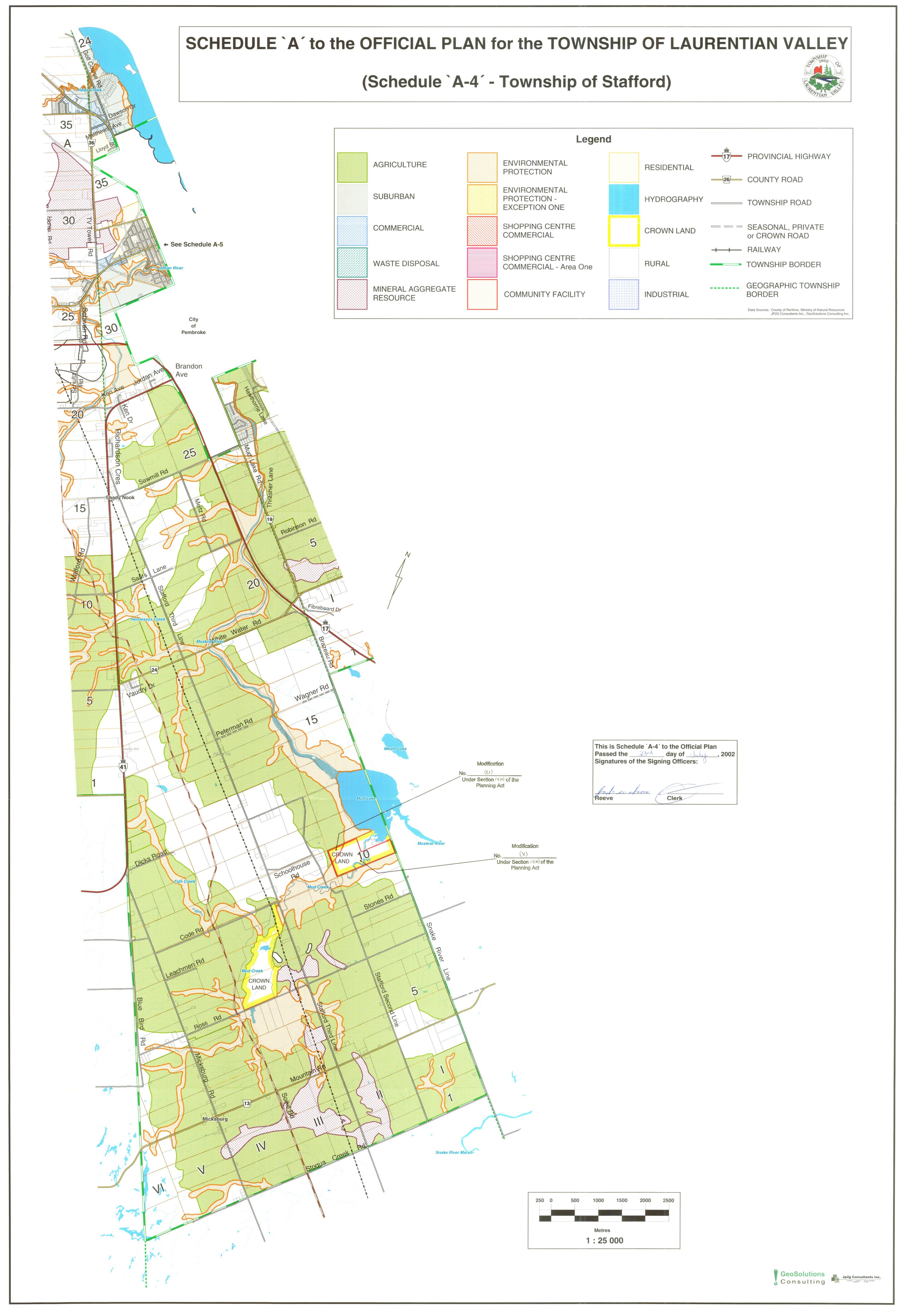
Schedule A4, Stafford Township |
|
|
|
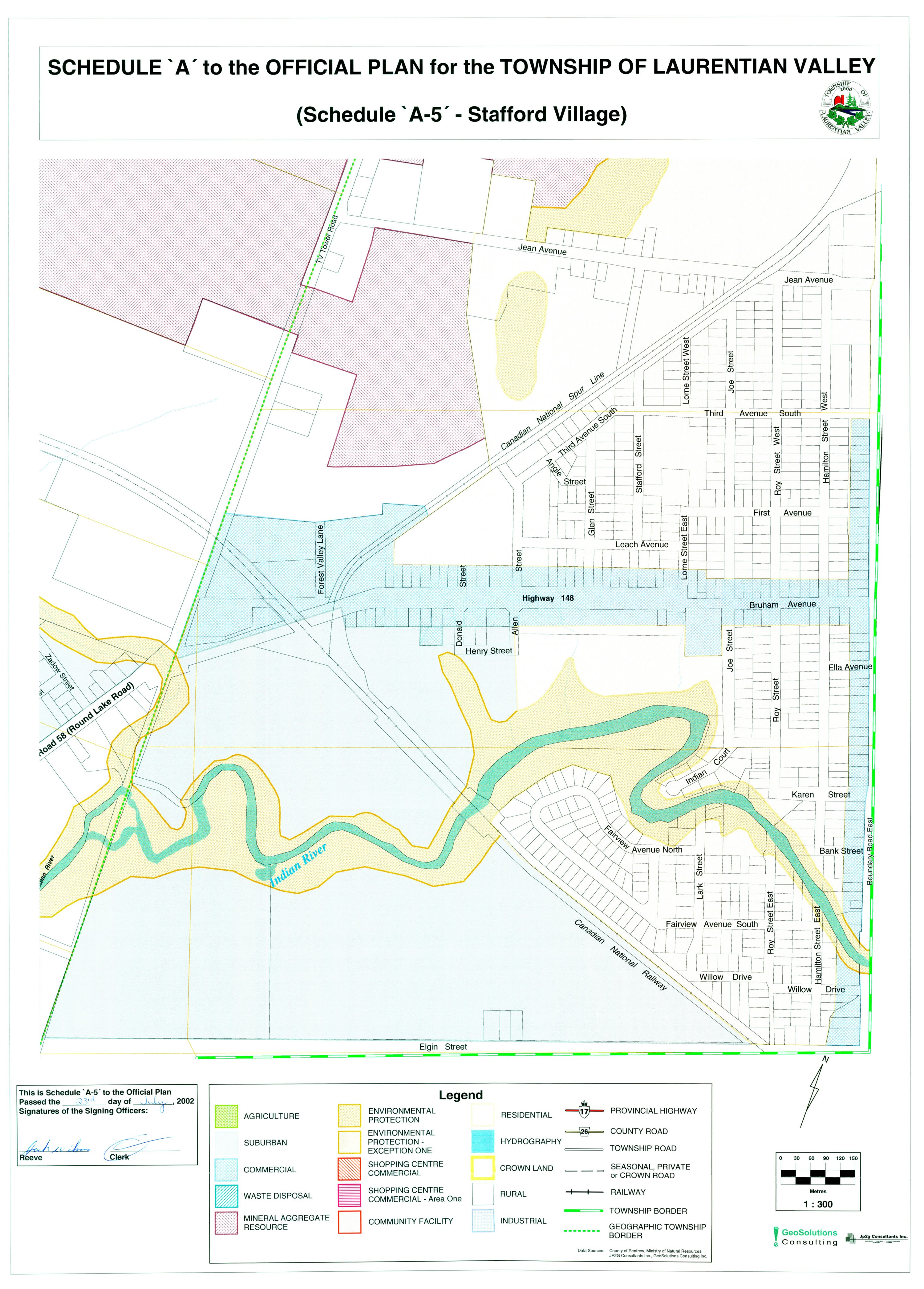
Schedule A5, Stafford Village |
|
|
|
Schedule B, Slope Stability |
|
|
|
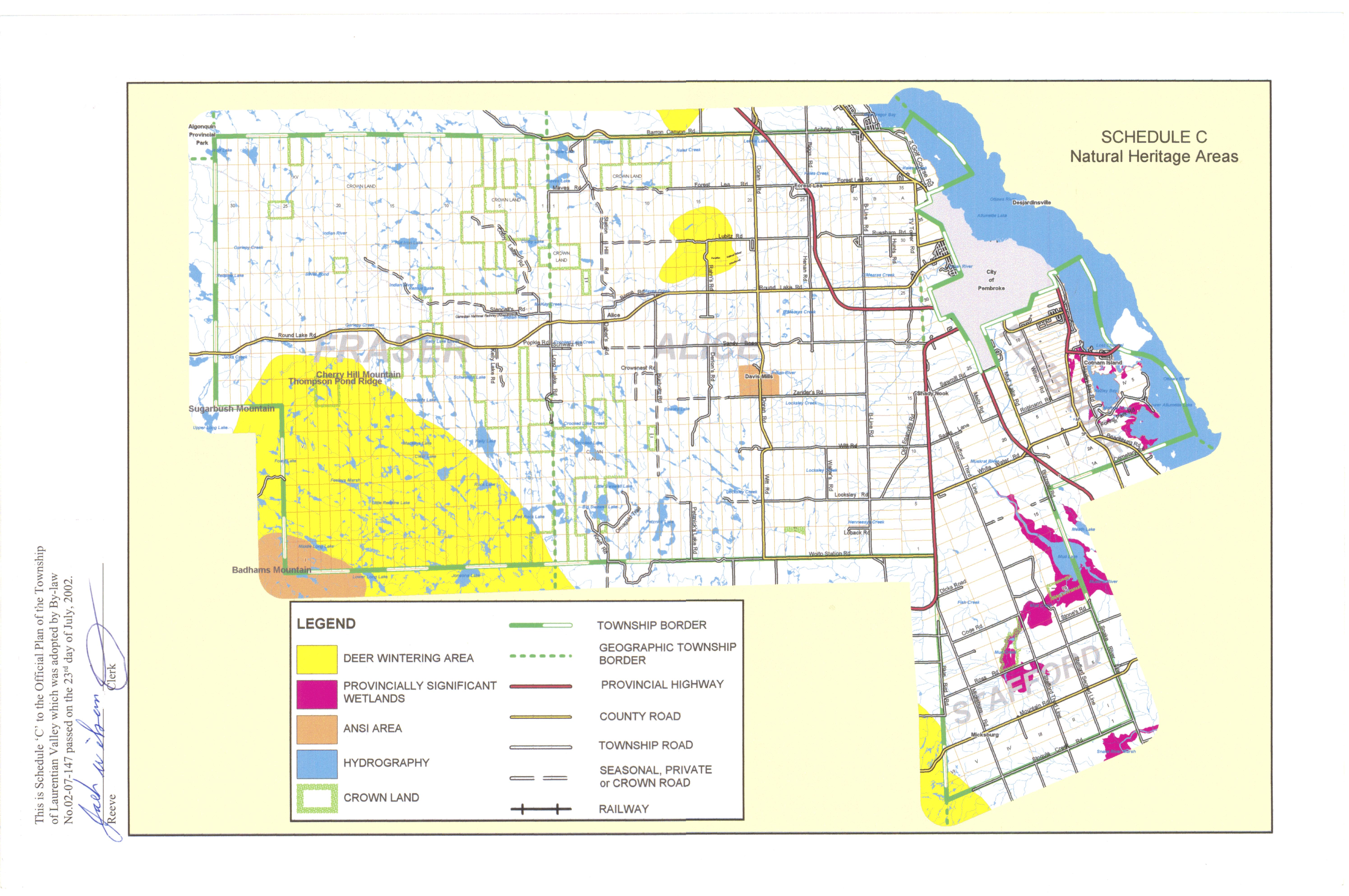
LV OP-schedule C |
|
|

For alternate formats, please call 613-735-6291.
County of Renfrew Official Plan
The County of Renfrew Official Plan came into effect for the Township of Laurentian Valley on March 26, 2020, as a result of a decision issued by the Minister of Municipal Affairs and Housing on Official Plan Amendment Number 25 to the County of Renfrew Official Plan. As a result, all planning approvals in the Township of Laurentian Valley must now also comply with the policies in the County of Renfrew Official Plan as the County of Renfrew is the upper tier government. Where there is a conflict between policies, whatever policy is more restrictive is the policy that applies.
All lands in the Township are designated “Township of Laurentian Valley” on Schedule A to the County Official Plan. There are five separate maps that make up Schedule B to the County Official Plan and each map needs to be reviewed for how it applies to a specific property.
Information on the County of Renfrew Official Plan is available on the County of Renfrew's website.
Where urban amenities meet outdoor rural fun.
LV is home to easy comfortable living.